After we left Hatfield Marine Science Center, we headed north to Devils Punchbowl, prior to driving up to
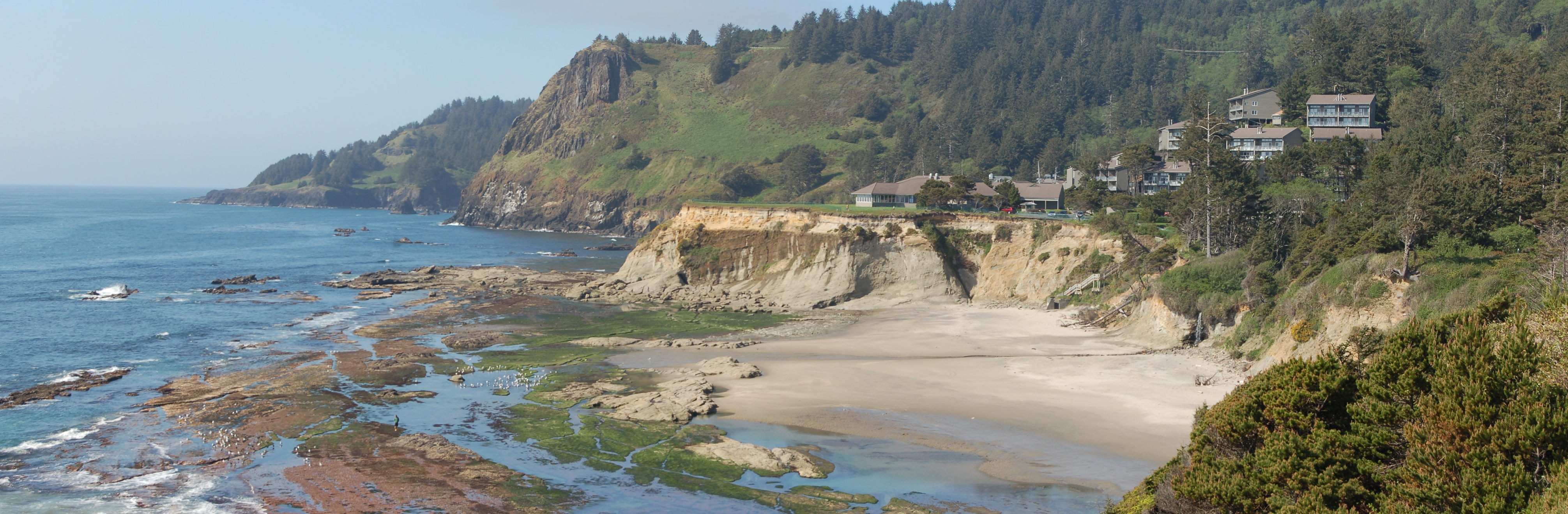
Otter Rock- the high point in the left-middle of this panorama. (
size options here- right click on the image) There's a lot going on in this photo. The most extraordinary aspect is the ring dike, displayed as a series of sea stacks outward and to the south (toward the viewer) of Otter Rock, where Columbia River Basalt reached the Pacific Ocean, flowed out onto the then-accumulating sediments of the Astoria Formation, and plunged into them, creating so-called invasive dikes. Not visible from this viewpoint, but clearly shown by the photo at the first link, there is actually a pair of ring dikes and some radial dikes as well. The sediments of the Astoria Formation have been tilted to the west at this location, and two generations of marine terraces have been developed on those rocks. What appears to be sandy beach deposits create an angular unconformity on the elevated terrace, where
The Inn at Otter Crest has been built. In addition to the elevated terrace of Otter Crest, it looks as if there's a somewhat more poorly developed terrace at roughly the same elevation in the CRB headland beyond Otter Rock. A small waterfall drops to the beach this side of the stairway from the inn. Finally, I can't see enough detail to be absolutely certain, but there are number of linear grooves that are likely faults across the modern, sea-level terrace.
Like I said, a lot going on here.
Photo unmodified. May 6, 2013.
FlashEarth location.


No comments:
Post a Comment